 |
||||
| Important information about the symbols click here | ||||
|
Route Description |
|
|
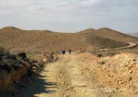
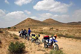
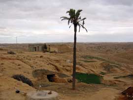
| The next few kilometers are partly sandy, partly gravel. After several kilometers, the mountains begin to appear. Following the waypoints, the route becomes more navigable. Now the contrast to the desert becomes noticeable. The road winds through the mountainous landscape. Occasionally, we encounter jeep drivers traveling in organized groups. We pass a small village. |  |
 |
After some time, you reach the town of Matmata. The paved road begins here. You can also refuel in New Matmata. From here, the paved road continues through the mountains. After about 15 kilometers, the plains begin again. From there, the mostly straight and partially busy road takes you to Douz. |
|
Where: Route Length: Approx. 240 km |
 |
Onlineshop Tunisia Ebook (EN)
| Info order item (e-book) | |
|
|
 |
|
| GPS data (included with the e-book) for individual navigation systems such as Garmin, TomTom, BMW Navigator, or GPX files for a mobile navigation app are included with the e-book. |
 Albania
 Romania Offroad
 Slovenia
 Pyrenees Offroad
 Iceland Offroad
 Croatia
 Montenegro
 Morocco Offroad
 Tunisia
 Andalusia1 (Spain)


