 Albania
 Romania Offroad
 Slovenia
 Pyrenees Offroad
 Iceland Offroad
 Croatia
 Montenegro
 Morocco Offroad
 Tunisia
 Andalusia1 (Spain)
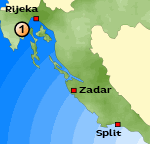 route length: 59 KM route length: 59 KMMax Height: 1400 Meter particularity: - passable for enduro and all-wheel |
|
The route was driven by a KTM 640, KTM 690 (2 Persons).
Important Information about the Symbols click here
|
 |
|
Route description
Our first itinerary in Croatia. From the coastal road a small paved road leads towards the Ucca mountains, which we follow. On individual houses on the slope, the path winds over. The wide and well developed gravel road is now steeper (about 14%). After a few kilometers we reach the first mountain crest. The route winds through the high Plateau |
 |
In the distance you can see a radar station on top of a mountain peak, our destination! After a few kilometers we reach the small tower on the summit. From the top you can see in clear weather to Venice. A little bit of the way we drive back again and then take the departure on the opposite side of the mountain.
|
 |

|
 |
The last kilometers up to the coast road we drive on a small tarred path. |
|
Where:
Croatia, Ucka Mountain Length of the Route : ca. 59 KM Map: Hiking Map Difficulty: - passable for enduro and all-wheel |
 |
 |
{mosmodule articleid=212}
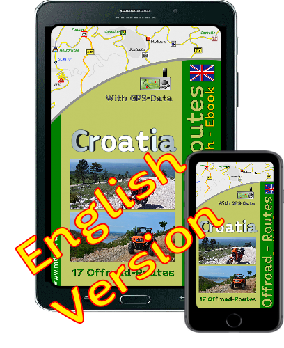
Onlineshop EN Tourbook Croatia Offroad
|
|
Offroadroutes in Croatia (EBook)
|
|
|
Load GPS data as a ZIP file from the Internet Included with the e-book is the option to load the GPS data from the Internet after purchase. Detailed information click here. |

Shop List
| 0 Products | - | 0.00 EUR |
| Go to cart | ||
Onlineshop (EN)

Shipping
There are no shipping charges for ebooks as the ebook and GPS data are sent via email.
We have 429 guests and no members online
- Articles View Hits
- 20676738