 Albania
 Romania Offroad
 Slovenia
 Pyrenees Offroad
 Iceland Offroad
 Croatia
 Montenegro
 Morocco Offroad
 Tunisia
 Andalusia1 (Spain)
|
Max Height: 1100 Meter particularity: |
|
|
 |
|
Route description
Beautiful route through forest with individual clearings. |
 |
 |
 |
 |
|
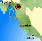
Where:
Croatia Length of the Route :
ca. 27 KM Map: - not shown - Difficulty:
- Gravel & forestway |
 |
 |
 |
{mosmodule articleid=212}
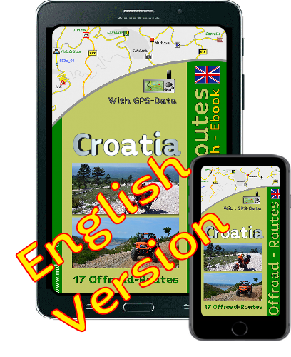
Onlineshop EN Tourbook Croatia Offroad
|
|
Offroadroutes in Croatia (EBook)
|
|
|
Load GPS data as a ZIP file from the Internet Included with the e-book is the option to load the GPS data from the Internet after purchase. Detailed information click here. |

Shop List
| 0 Products | - | 0.00 EUR |
| Go to cart | ||
Onlineshop (EN)

Shipping
There are no shipping charges for ebooks as the ebook and GPS data are sent via email.
We have 393 guests and no members online
- Articles View Hits
- 20676738