 Albania
 Romania Offroad
 Slovenia
 Pyrenees Offroad
 Iceland Offroad
 Croatia
 Montenegro
 Morocco Offroad
 Tunisia
 Andalusia1 (Spain)
|
Max Height: 900 Meter particularity: |
|
The route was driven by a KTM 640, KTM 950 Adventure (2 Persons).
Important Information about the Symbols click here
|
 |
|
Route description
A second route uphill to the Ucka mountains. It starts in a small village near a railway barrier. The first kilometers are partly deep gravelled. |
 |
 |
 |
 |
On the slopes along the gravel road moves into Ucca Mountains. The view is amazing, as there are virtually no trees along the way. Once at the summit, there are whole fields of wild peonies. Here, too, nature invites you to linger. We continue over the mountain ridge to get back to the valley via further gravelled paths. The last 5 kilometers we then drive over a small one-lane tear road with beautiful views to the sea. |
|
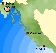
Where:
Croatia - Ukka Mountain Length nof the Route :
ca. 35 KM Map: Hiking Map Difficulty: - deep gravelled sections |
 |
 |
{mosmodule articleid=212}
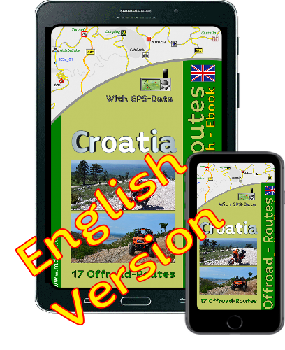
Onlineshop EN Tourbook Croatia Offroad
|
|
Offroadroutes in Croatia (EBook)
|
|
|
Load GPS data as a ZIP file from the Internet Included with the e-book is the option to load the GPS data from the Internet after purchase. Detailed information click here. |

Shop List
| 0 Products | - | 0.00 EUR |
| Go to cart | ||
Onlineshop (EN)

Shipping
There are no shipping charges for ebooks as the ebook and GPS data are sent via email.
We have 678 guests and no members online
- Articles View Hits
- 20562604